Understanding Forest Hiking Trails in United States Forest Landscapes
United States forest landscapes encompass more than one hundred fifty national forests administered by the U.S. Forest Service, alongside state forests, tribal woodlands, Bureau of Land Management parcels, and forested units within the National Park System. These lands span temperate rainforests of the Pacific Northwest, longleaf pine savannas of the Southeast, aspen groves of the Rocky Mountains, maple-beech hardwoods of the Northeast, and saguaro-studded sky islands of the Southwest. Educational travelers researching forest hiking trails and route selection benefit from treating forests as dynamic ecosystems managed for multiple purposes rather than as uniform wilderness backdrops.
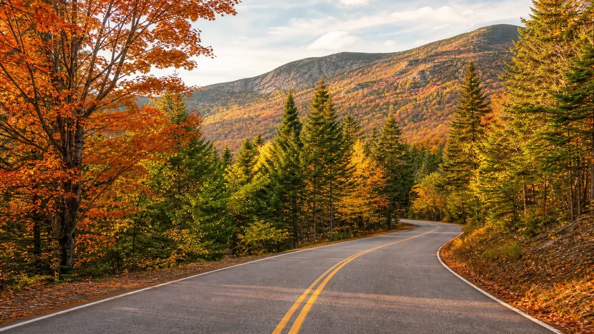
Forest travel differs from urban or coastal tourism in ways that affect planning depth. Road networks include paved scenic byways and single-lane dirt tracks closed seasonally by snow gates. Trail maintenance priorities shift after wildfire, blowdown, and budget cycles. Wildlife presence varies by elevation band, season, and recent habitat disturbance. Cell coverage gaps span entire mountain ranges. Educational preparation emphasizes verification through official agency websites, Motor Vehicle Use Maps, trail condition bulletins, and ranger station conversations rather than assumptions drawn from outdated guidebooks or social media posts.
This guide presents general educational information about forest travel across the United States. It does not constitute personalized travel advice, guarantees of trail conditions, wildlife sightings, weather, facility availability, or safety outcomes. Always verify current conditions through official sources such as the U.S. Forest Service, National Park Service, state park agencies, and local ranger districts before departing.
Frameworks for Selecting Forest Hiking Trails
Forest hiking in the United States spans thousands of miles of maintained trails in national forests, national parks, state forests, tribal lands, and municipal open-space networks. Route selection begins with honest assessment of group fitness, recent training, elevation exposure, and experience with off-trail navigation. A trail rated moderate in a coastal range may feel strenuous when duplicated at ten thousand feet in Colorado with less oxygen available per breath.
Published guidebooks, official agency trail pages, and topographic maps provide complementary information. Digital applications display crowdsourced conditions that may be outdated or describe routes beyond your intended season. Cross-reference multiple sources and confirm with ranger stations when possible before committing to remote loops through dense woodland where signage spacing increases between junctions.
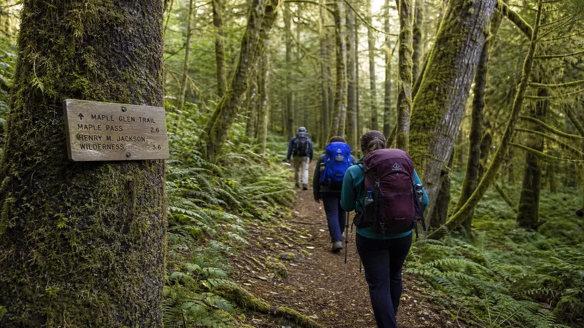
Forest trails differ from alpine mountaineering routes and from urban paved paths in tread character, maintenance frequency, and hazard profiles. Rooty eastern hardwood paths, rocky western talus, sandy longleaf pine corridors, and boardwalks through southeastern swamps each demand different footwear and pacing assumptions. Educational hikers read narrative descriptions for words such as scramble, ford, bushwhack, or route-finding that signal skills beyond walking.
Trail Classification Systems and What They Omit
Agencies use varied terminology without a single national standard. A strenuous label typically indicates sustained elevation gain, rough tread, or exposure to heights, but does not quantify technical rock climbing or river fording requirements. Round-trip distance alone misleads when elevation gain exceeds one thousand feet per mile. Time estimates on signage assume average fitness on dry tread; mud, snow, or humid heat can double planned durations.
Accessibility ratings appear on some developed nature trails with firm surfaces and gentle grades, while backcountry forest paths may lack any formal rating despite steep sidehill sections and creek crossings without bridges.
- Record elevation profiles from official PDF maps or USGS topo quadrangles when apps disagree.
- Note whether trails allow horses or bicycles; shared use affects tread churn and passing etiquette.
- Identify bailout routes or shorter loop options if mid-hike fatigue appears.
- Check whether hunting seasons require blaze orange on shared forest corridors.
Regional Forest Trail Networks Worth Studying
Appalachian forest trails cross fourteen states along the eastern ridgeline, offering section hikes accessible from hundreds of road crossings through mixed hardwood and conifer zones. Western long trails including the Pacific Crest Trail and Continental Divide Trail traverse forested wilderness requiring permits and food storage compliance in bear country. Iconic national park routes require lottery or quota systems that change annually.
Forest service trail systems connect peaks below the fame threshold of national parks, often with fewer crowds but less frequent maintenance after wildfire or blowdown events. State forest trails in places such as Pennsylvania's Allegheny National Forest and Wisconsin's Northwoods provide structured parking and interpretive signage suitable for skill building.
Old-growth forest interpretive trails in units such as Olympic National Forest adjunct lands, Redwoods National and State Parks buffer forests, and Joyce Kilmer Memorial Forest in Nantahala National Forest offer educational walks among large-diameter trees without guaranteeing identical canopy conditions after storms or management actions.
Loop, Out-and-Back, and Point-to-Point Logic
Out-and-back hikes simplify navigation and allow turnaround when conditions deteriorate, but repeat scenery on return legs. Loop trails diversify views yet trap hikers on long segments if injury occurs unless alternate exits exist. Point-to-point hikes require shuttle coordination or two-vehicle staging at separate trailheads connected by forest roads.
Ridge walks with multiple minor summits tempt peak bagging beyond planned energy budgets. Select a primary objective and treat secondary peaks as optional to preserve safety margins descending before afternoon thunderstorm seasons common in eastern and Rocky Mountain forests alike.
- Share written itineraries with a contact including trailhead name and expected return hour.
- Photograph junction signs at confusing intersections for reference if retreat becomes necessary.
- Carry paper maps even when GPS tracks are loaded; batteries fail in cold humid forest air.
- Mark parking location coordinates when trailheads serve multiple trail systems.
Seasonal Access and Surface Conditions on Forest Trails
Trails at moderate elevation in northern forests may remain snow-covered into April during heavy snow years. Microspikes or traction devices help on hard-packed spring snow in shaded ravines. Early-season melt creates muddy tread that damages vegetation when hikers widen paths by walking around saturated sections.
Fall hiking brings shorter days and hunting seasons in many states requiring blaze orange clothing on forest routes shared with licensed hunters. Winter low-elevation hikes remain accessible in southern pine forests while northern routes require snowshoes and avalanche literacy near steep forest openings.
Summer humidity in southeastern forests increases heat stress despite shaded canopy; western dry forests pose dehydration risks at elevation with intense sun in fire-scar openings lacking shade until regrowth advances.
Water Crossings and Weather Windows
Forest streams swell during afternoon thunderstorms and after regional rain events. Log crossings rot and shift; rock hops become dangerous when discharge rises unexpectedly. Turn back rather than ford swift cold water above knee depth without appropriate training and equipment.
Start longer forest hikes early to complete exposed ridge segments before cumulus build-up. Lightning strikes ridge crests and tall trees regularly in summer; NOAA weather radio and official alerts supplement visual cloud monitoring. Descend to lower elevations when thunder is audible within thirty seconds of lightning flash.
- Pack rain shells even when morning forecasts show clear skies under forest canopy.
- Treat stream water before drinking unless agency signage certifies a treated fountain at trailhead only.
- Monitor heat index on exposed forest openings and recent burn scars where shade is sparse.
- Respect mud-season trail closures posted to protect tread in thawing northern hardwood forests.
Navigation Skills and Junction Discipline in Wooded Terrain
Paint blazes, plastic tags, cairns, carved signs, and GPS waypoints each fail independently in forest settings. Blaze paint fades on damp bark; cairns confuse in talus fields where multiple rock piles appear; GPS drifts under cliff walls and dense canopy. Combine tools and pause at each junction until route confirmation is unanimous within the group.
Unmaintained social trails branch from popular paths toward unofficial viewpoints; stay on designated routes unless map and compass confirm intentional alternate paths legal for your trip type. Forest understory visibility limits sight lines, making wrong-turn recovery slower than in open terrain.
Group Dynamics and Pace Management
Hike with the slowest member's sustainable pace on ascent; separate only where trails are unambiguous and regroup points are predetermined. Children and older adults overheat or chill faster than middle-aged hikers anticipate in variable forest microclimates.
Trail runners passing quietly should announce presence; hikers yielding uphill on narrow paths reduces collision risk on rooty tread. Headphones at high volume prevent hearing approaching wildlife or falling branch warnings during wind events.
- Assign a navigator and a sweep on hikes exceeding five miles in complex terrain.
- Practice converting map declination to compass bearing before relying on skills in fog.
- Carry whistle and bright layer for signaling if separated from group in dense woods.
- Review turnaround times based on sunset rather than optimistic outbound pace alone.
Gear, Food Storage, and Leave No Trace on Forest Trails
Ten essentials lists published by outdoor organizations consistently emphasize insulation, illumination, first aid, repair tools, nutrition, hydration, sun protection, navigation, and emergency shelter concepts adapted to day-hike scale. Tailor quantities to trip length and remoteness from forest trailheads where cell coverage may end within the first mile.
Pack out all trash including fruit peels and tissue. Use established vault toilets at trailheads; in wilderness requiring catholes, locate them far from watercourses following agency depth and distance guidelines. Stay on durable surfaces; cutting switchbacks erodes hillsides visible for years in steep forest terrain.
Wildlife and Food Storage Along Forest Corridors
Bear-canister requirements apply in portions of Sierra Nevada, Rocky Mountain, and Appalachian corridors even for day hikers leaving food unattended in vehicles at trailheads. Never approach wildlife for photographs; use binoculars from distances that allow animals to continue natural behavior.
Dogs where permitted must remain leashed on many busy forest trails; pet waste belongs in pack-out bags, not buried beside tread where decomposition differs from lowland soil conditions.
- Repack food in odor-reducing bags when canisters not mandated but bears active regionally.
- Carry blister care and moleskin; small foot issues become debilitating on long forest descents.
- Adjust layering systems for stop-time cooling under damp evergreen shade.
- Report trail damage such as downed trees through official maintenance request channels when available.
Building Skills Through Progressive Forest Hikes
Advance from short nature loops with interpretive panels to half-day elevation gains before attempting remote traverses requiring exposure management or multi-day navigation. Skills accumulate through repetition: reading trail markers, pacing on stairs built into steep forest grades, managing wet footing on rooty eastern paths versus rocky western slopes.
Volunteer trail maintenance days organized by friends-of-forest groups teach construction standards for drainage dips and rock steps. Participation supports public lands while revealing how maintenance backlog affects route difficulty after storms.
Educational value increases when hikers journal plant species, fungi, bird calls, and trail conditions dated to their visit rather than treating experiences as timeless guarantees for others.
Connecting Forest Hikes With Broader Travel Itineraries
Pair morning forest hikes with afternoon scenic drives or visitor center programs to diversify pacing across multi-day trips. Reserve energy for driving on winding forest roads after long hikes by scheduling rest evenings in gateway towns with grocery and fuel access.
Compare trail difficulty across regions when transferring habits from familiar local forests to new ecoregions with different humidity, altitude, and tread characteristics.
- Log personal hikes with conditions notes to refine future packing lists seasonally.
- Take wilderness first aid courses if regularly hiking beyond cell coverage in national forests.
- Reassess fitness seasonally; winter inactivity affects summer performance on humid forest climbs.
- Archive official trail bulletins with dates for personal reference on return visits.