Understanding Forest Scenic Drives in United States Forest Landscapes
United States forest landscapes encompass more than one hundred fifty national forests administered by the U.S. Forest Service, alongside state forests, tribal woodlands, Bureau of Land Management parcels, and forested units within the National Park System. These lands span temperate rainforests of the Pacific Northwest, longleaf pine savannas of the Southeast, aspen groves of the Rocky Mountains, maple-beech hardwoods of the Northeast, and saguaro-studded sky islands of the Southwest. Educational travelers researching scenic driving through American forest corridors benefit from treating forests as dynamic ecosystems managed for multiple purposes rather than as uniform wilderness backdrops.
Forest travel differs from urban or coastal tourism in ways that affect planning depth. Road networks include paved scenic byways and single-lane dirt tracks closed seasonally by snow gates. Trail maintenance priorities shift after wildfire, blowdown, and budget cycles. Wildlife presence varies by elevation band, season, and recent habitat disturbance. Cell coverage gaps span entire mountain ranges. Educational preparation emphasizes verification through official agency websites, Motor Vehicle Use Maps, trail condition bulletins, and ranger station conversations rather than assumptions drawn from outdated guidebooks or social media posts.
This guide presents general educational information about forest travel across the United States. It does not constitute personalized travel advice, guarantees of trail conditions, wildlife sightings, weather, facility availability, or safety outcomes. Always verify current conditions through official sources such as the U.S. Forest Service, National Park Service, state park agencies, and local ranger districts before departing.
How Forest Scenic Corridors Differ From Highway Travel
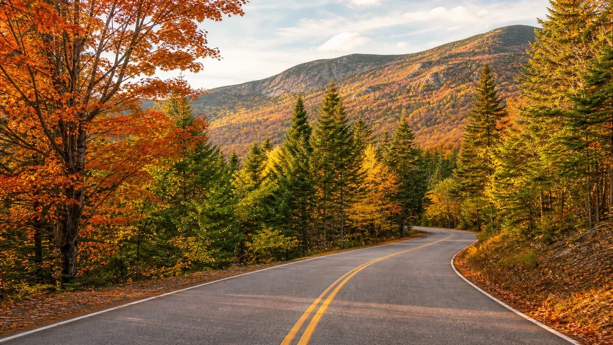
Forest scenic drives follow roads crossing national forests, state woodlands, and park buffers where tree canopy frames travel for miles between designated overlooks. Unlike interstate highways optimized for speed and uniformity, forest routes often trace older transportation paths shaped by logging access, CCC-era construction, mining supply lines, and recreational development plans from the mid-twentieth century.
Scenic designation describes a planning framework and interpretive context rather than a promise of continuous panoramic views from every mile of pavement. Blue Ridge Parkway, Olympic Peninsula loop segments, Going-to-the-Sun Road approaches through forested valleys, and countless state byways through pine and hardwood zones reward travelers who research pullout locations, seasonal closures, and one-way restrictions before departure.
Educational drivers evaluate routes using official byway management plans, state transportation scenic highway maps, and forest MVUM resources describing road surfaces and seasonal gates. Third-party listicles often compress diverse corridors into generic recommendations without noting construction, flooding, or segments better suited to particular travel directions for lighting and safe stopping.
Reading Official Scenic Route Resources
National scenic byway designation involves nomination, corridor management planning, and coordination among federal, state, tribal, and local partners. Designation may qualify corridors for promotional support but does not automatically widen roads or add new overlooks. State scenic highway programs cover routes without national designation yet provide excellent interpretive experiences through hardwood forests and river gorges.
Travelers should distinguish scenic byways from spur routes branching to state park peninsulas, fire lookout towers, or campground loops that add time but often yield quieter experiences away from through traffic using forest roads as shortcuts.
- Download official corridor maps showing designated route continuity and spur alternatives.
- Read management plan summaries describing cultural and ecological themes each route emphasizes.
- Verify whether routes are one-way, seasonally closed, or restricted to certain vehicle classes.
- Compare sunrise and sunset orientations along route segments when planning photography stops.
Iconic Forest Scenic Corridors Across the Country
The Blue Ridge Parkway connects Shenandoah and Great Smoky Mountains National Parks through Appalachian hardwood forests with hundreds of overlooks, hiking trailheads, and cultural interpretation sites. Congestion appears at major overlooks during October foliage weekends; winter closures affect sections at highest elevations without snow removal.
Pacific Northwest forest drives including Mount Rainier loop approaches, Oregon Coast Range connections to Coast Range passes, and the Columbia River Gorge tree-lined segments combine dense conifer forest with waterfall viewpoints and river confluence pullouts. Rain and low clouds reduce long-distance visibility while enhancing moss and stream photography opportunities near road grade.
Rocky Mountain forest byways such as the San Juan Skyway, Beartooth Highway approaches through lodgepole zones, and Front Range Poudre Canyon routes illustrate rapid elevation transitions from grassland to subalpine forest within single afternoon drives. Fall aspen color draws heavy visitation on narrow two-lane segments requiring patience at pullouts.
Lesser-Known Forest Drive Networks
Black Hills National Forest scenic loops, Ouachita National Forest ridge routes, and Upper Peninsula Michigan forest highways offer lower crowds with strong autumn color and wildlife viewing pullouts when researched through regional tourism offices and forest recreation pages.
Southeastern forest drives through longleaf pine restoration areas and bottomland hardwood corridors along rivers illustrate fire-adapted ecology visible from paved routes when pullouts align with interpretive signage.
- Investigate Arkansas Ozark and Ouachita forest routes for fall color alternatives to crowded Appalachian parkways.
- Explore Michigan Hiawatha National Forest lake shore drives combining forest and freshwater views.
- Check Smoky Mountain adjacent forest roads when park main roads congest during peak weeks.
- Use state DOT 511 systems for real-time closure data on high-elevation forest passes.
Route Selection by Travel Goals and Season
Scenic route selection improves when travelers articulate primary interests: old-growth forest interpretation, fall foliage, wildflower meadows visible from road grade, birding pullouts, or gentle waterfall walks from roadside trailheads. A geology-focused Columbia Gorge itinerary might emphasize basalt and waterfall trails; an Appalachian cultural route might prioritize craft communities and historic grist mills in forested valleys.
Seasonal variation transforms scenic quality without changing mile markers. Spring high water enlarges stream views from bridge pullouts while submerging some low picnic areas. Summer haze and recreational traffic peak on popular corridors. Autumn brings foliage color to riparian hardwoods along northeastern and northwoods routes. Winter exposes cliff faces and reduces foliage obstruction while closing some high passes.
Matching Routes to Light and Weather
Light direction affects east-facing overlooks on westbound morning drives and vice versa. Educational photographers plan route direction relative to sun position when possible, recognizing that safety and legal parking limit ideal alignment on many forest road segments with dense shoulder vegetation.
Fog and low clouds common in Pacific Northwest and Appalachian mornings may lift by afternoon or persist for days during inversion patterns; flexible itineraries accommodate weather without assuming clear long views.
- Consult foliage prediction resources for northeastern and northwoods corridors before October trips.
- Check waterfall flow reports in gorge areas where summer drought reduces dramatic cascades visible from roads.
- Review winter road maintenance policies for high-elevation forest passes prone to ice.
- Schedule overlooks during softer light while maintaining safe stopping at designated pullouts only.
Infrastructure and Visitor Experience on Forest Roads
Scenic drive experience depends heavily on pullout design, interpretive signage, restroom availability, and parking capacity at key viewpoints. Well-managed corridors provide frequent legal stopping opportunities with crash barriers and sight lines engineered for safety. Underinvested segments may offer views visible only through windshield glass because narrow shoulders prohibit safe stopping.
Forest roads carrying logging and recreation traffic simultaneously require defensive driving habits: expect oncoming vehicles on one-lane sections, gravel surfaces reducing traction, and dust reducing visibility behind slow-moving campers on dry summer roads.
Signage and Interpretive Programs Along Drives
Interpretive signage along scenic byways varies from comprehensive panels explaining ecology and history to minimal route markers assuming prior research. Visitor centers at corridor midpoints distribute maps and discuss current conditions with staff when available. Ranger programs in national park and forest units overlapping scenic routes add depth during summer seasons.
Self-guided audio tours produced by state tourism offices supplement signage when downloaded before losing cellular service in remote valleys.
- Stop at official visitor centers early in trips to collect current maps and event calendars.
- Download state tourism audio guides before entering corridors with known dead zones.
- Photograph interpretive panels for later review rather than blocking pullouts during busy periods.
- Respect private property boundaries when views cross working forests and farms from public roads.
Vehicle Considerations and Road Surface Realities
Most established forest scenic byways accommodate standard passenger vehicles, but optional detours to gravel lookout access roads and unpaved wildlife refuge routes may require higher clearance or cautious driving after rain. RV travelers should verify bridge weight limits, downtown street restrictions in forest gateway towns, and length limits at campground turnoffs on winding grades.
Electric vehicle drivers plan charging in gateway communities before long forest loops where stations remain sparse. Rental car agreements may exclude gravel forest roads; verify before exploring MVUM routes beyond paved byways.
Seasonal Closures and Gate Status
Snow gates close elevation-dependent segments from November through May in many western and northern forests. Gate status may not appear in real time online; call district offices during business hours for verbal confirmation when trip timing is tight.
Spring mud season closures protect road beds from rutting when soils thaw. Violating closed gates risks fines and tow bills from soft-shoulder extractions on clay-rich forest roads.
- Carry traction devices where state law requires them on mountain passes crossing forest land.
- Never move locked gate chains; some access requires permit keys from ranger stations.
- Note that hunting seasons increase traffic and roadside parking near popular forest trailheads along drives.
- Carry paper maps when GPS routing suggests questionable shortcuts on forest tracks.
Responsible Travel Along Forest Scenic Routes
Forest corridors face cumulative pressures from recreation, litter, illegal campfire rings at informal pullouts, and habitat fragmentation along road edges. Educational travelers reduce impact by staying on designated paths at roadside viewpoints, packing out litter, and obeying speed limits protecting wildlife crossing at dawn and dusk.
Supporting gateway communities through lawful purchases at local businesses helps maintain services future visitors rely on. Learning about current watershed health issues, invasive species, and forest management debates enriches travel with contemporary relevance beyond scenic nostalgia.
Combining Drives With Short Walks
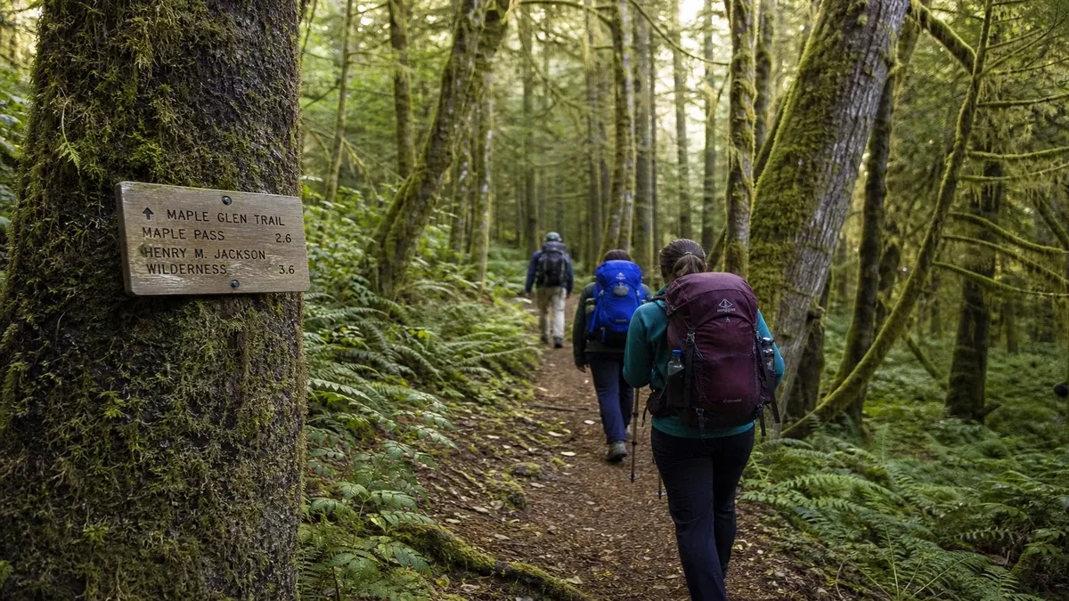
Many scenic forest routes connect to short interpretive trails, waterfall walks, and nature loops under one mile that break up long driving days with leg-stretching and educational stops. Research trailhead parking limits before committing to popular roadside hikes that overflow onto narrow shoulders.
Balanced itineraries alternate driving-intensive days with hiking or visitor center days centered in one gateway town to reduce fatigue on winding roads.
- Follow Leave No Trace principles at informal overlooks lacking maintained facilities.
- Obey posted drone restrictions near wilderness boundaries and refuges visible from scenic roads.
- Share trip reports mentioning seasonal conditions to help other educational travelers plan realistically.
- Limit planned driving hours per day on winding two-lane forest roads to maintain alertness.