Understanding Forest Outdoor Safety in United States Forest Landscapes
United States forest landscapes encompass more than one hundred fifty national forests administered by the U.S. Forest Service, alongside state forests, tribal woodlands, Bureau of Land Management parcels, and forested units within the National Park System. These lands span temperate rainforests of the Pacific Northwest, longleaf pine savannas of the Southeast, aspen groves of the Rocky Mountains, maple-beech hardwoods of the Northeast, and saguaro-studded sky islands of the Southwest. Educational travelers researching safety awareness for forest outdoor recreation benefit from treating forests as dynamic ecosystems managed for multiple purposes rather than as uniform wilderness backdrops.
Forest travel differs from urban or coastal tourism in ways that affect planning depth. Road networks include paved scenic byways and single-lane dirt tracks closed seasonally by snow gates. Trail maintenance priorities shift after wildfire, blowdown, and budget cycles. Wildlife presence varies by elevation band, season, and recent habitat disturbance. Cell coverage gaps span entire mountain ranges. Educational preparation emphasizes verification through official agency websites, Motor Vehicle Use Maps, trail condition bulletins, and ranger station conversations rather than assumptions drawn from outdated guidebooks or social media posts.
This guide presents general educational information about forest travel across the United States. It does not constitute personalized travel advice, guarantees of trail conditions, wildlife sightings, weather, facility availability, or safety outcomes. Always verify current conditions through official sources such as the U.S. Forest Service, National Park Service, state park agencies, and local ranger districts before departing.
Foundations of Forest Outdoor Safety Planning
Forest outdoor safety begins before departure with itinerary sharing, weather monitoring, equipment checks, and honest assessment of group skills relative to terrain, remoteness, and season. No preparation eliminates all risk from weather, wildlife, navigation errors, medical events, or road hazards on forest access routes.
Educational safety planning distinguishes between general preparedness and personalized medical decisions requiring licensed professional input. Cardiac, respiratory, mobility, and pregnancy considerations interact with altitude, humidity, cold, and exertion differently for each individual.
Official sources including National Weather Service, forest service alerts, state transportation departments, and local sheriff search-and-rescue advisories provide condition-specific information general guides cannot replicate in real time.
Trip Communication and Documentation
Share written itineraries with trusted contacts including vehicle description, planned trailheads, and check-in intervals matched honestly to expected cell coverage gaps spanning entire forest counties. Satellite messengers require subscription activation and practice before relying on them in emergencies.
Carry identification, medical information, and insurance documentation appropriate to personal circumstances when recreating on remote forest trails.
- Save offline maps covering entire planned regions before losing cell signal at forest boundaries.
- Establish regroup points on group hikes before separating on loop trails with multiple junctions.
- Photograph trailhead condition boards with dates at trip start for personal safety records.
- Know that SOS devices may not replace situational prevention and conservative turn-back decisions.
Weather, Lightning, and Flood Hazards in Forests
Thunderstorms develop rapidly in summer mountain and interior forest regions. Start exposed ridge and open forest meadow hikes early; descend below treeline when thunder audible within thirty seconds of lightning flash. Avoid isolated tall trees, ridge crests, and open shallow caves that do not provide safe shelter.
Flash floods threaten narrow forest gorges and camp sites near streams when upstream rain not visible locally raises water quickly. Turn back when water muddies or rises during hikes through slot-like stream corridors.
Hypothermia remains possible in wet cold conditions even when air temperatures feel mild; forest shade and wind after rain accelerate cooling during stationary breaks.
Wind, Cold, and Heat in Forest Microclimates
Wind exposure increases on forest edges adjacent to open burns, lakes, and ridge gaps while deep interior feels calmer. Heat stress accumulates in humid southeastern forests despite shade; dehydration sneaks up on hikers who feel cool under canopy.
Winter forest travel requires layered clothing, spare insulation, and headlamps when short daylight surprises late starts on snow-packed trails.
- Pack rain shells even when morning forecasts show clear skies under deceptive calm forest mornings.
- Monitor heat index and take rest breaks during afternoon exertion in humid low-elevation forests.
- Carry chemical hand warmers for extended static stops during cold-season wildlife observation.
- Check NOAA weather radio or official alerts when hiking multi-day forest routes beyond cell range.
Navigation, Signaling, and Staying Found
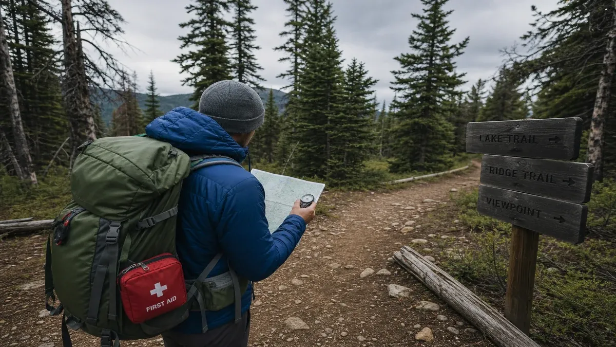
Forest understory limits sight lines, making wrong-turn recovery slower than open terrain. Carry paper maps and compass even when GPS tracks loaded; batteries fail in cold humid conditions. Pause at each junction until route confirmation unanimous within group before proceeding.
Whistles, bright clothing, and mirrors assist signaling when separated from group in dense woods. Three short whistle blasts represent universal distress signal in many outdoor education frameworks.
When to Turn Back
Conservative turnaround decisions when weather deteriorates, water crossings rise, group fatigue appears, or navigation uncertainty grows generally improve outcomes more than summit or loop completion goals forged under pressure.
Document turnaround times based on sunset and storm forecasts rather than optimistic outbound pace alone on rooty forest trails slowing descent.
- Mark parking coordinates when trailheads serve multiple overlapping trail systems.
- Practice map declination correction before relying on compass skills during fog in forested ridges.
- Assign navigator and sweep roles on complex multi-junction forest loop hikes.
- Accept that unfinished routes remain available for future visits when conditions improve.
Wildlife Encounters and Food Storage Safety
Bear country protocols include approved food storage, clean camps, and carrying bear spray where permitted and legal with training from official wildlife agency materials. Never approach wildlife for photographs; maintain distances mandated by signage and regional guidelines.
Moose, elk during rut, cow elk with calves, and feral hogs require additional space and escape route awareness. Snakes occur in rocky forest openings and southern pine woods; watch foot placement when stepping over logs.
After an Encounter
Report aggressive or food-conditioned animals to rangers before situations escalate to mandatory area closures. If charged or injured, seek medical care and document circumstances for agency follow-up without attempting to locate animals afterward.
Leash dogs where required; off-leash dogs trigger defensive behavior from moose and bears common in forest campgrounds adjacent to wildland.
- Store scented items with food according to local bear regulations every night and during day hikes from camp.
- Never run from bears unless specific agency guidance for imminent charge scenarios applies; backing away calmly often resolves encounters.
- Conduct tick checks after forest walks following CDC removal guidance.
- Learn regional venomous snake ranges before stepping off trail in rocky southeastern and southwestern forests.
First Aid, Medical Preparedness, and Emergency Response
Basic first aid kits tailored to trip length, group size, and remoteness support blister care, wound cleaning, sprain stabilization, and allergic reaction supplies personal medical providers recommend. Wilderness first aid courses help groups beyond cell coverage though certification does not guarantee outcomes.
Nearest hospital distances may exceed an hour on winding forest roads; identify urgent care locations in gateway towns before remote multi-day trips. Helicopter rescue availability and insurance limitations deserve advance research with personal providers.
Common Forest Trail Injuries
Slips on rooty tread, ankle rolls on uneven surfaces, and dehydration represent frequent forest trail issues preventable through footwear choice, pacing, and scheduled hydration stops. Eye injuries from branches require glasses or sunglasses even under canopy.
Hypothermia and heat illness extremes both occur in forests seasonally; companions should watch for confusion, shivering cessation, or cessation of sweating as serious signs warranting descent and medical evaluation.
- Carry moleskin and blister care supplies; small foot issues become debilitating on long forest descents.
- Know location of nearest AED in developed recreation areas when available at visitor centers.
- Do not rely on general articles for medication dosing or prevention protocols; consult clinicians.
- Pack epinephrine auto-injectors if prescribed; forest exposure to stinging insects and foods remains possible.
Road Safety and Vehicle Preparedness for Forest Access
Forest access roads present hazards distinct from highway travel: logging traffic, gravel surfaces, steep grades, wildlife crossings at dawn and dusk, and snow or ice on shaded passes. Maintain fuel above half tank when crossing long segments between stations in rural forest corridors.
Tire condition, spare inflation, and legal traction device carriage matter on mountain passes crossing forest land under state chain laws. Runaway truck ramps and chain-up areas appear on descent routes; use pullouts safely without blocking.
Breakdown and Stranding Protocols
Carry blankets, water, headlamps, and charged phones when driving remote forest roads in shoulder seasons. Overnight stranding occurs when storms close passes behind travelers who lacked flex time in itineraries.
Inform lodging hosts of late arrival only when necessary; rural check-in desks close early while forest roads remain hazardous after dark on unfamiliar routes.
- Clear snow from vehicle roof and lights before driving after forest parking during winter trips.
- Verify rental car policies on gravel forest roads before exploring MVUM routes beyond pavement.
- Avoid driving across flooded forest road dips; turn around when water depth unknown.
- Share driving responsibilities on long winding days to maintain alertness approaching trailheads.
Integrating Safety Into Educational Forest Travel Culture
Safety-conscious forest travel treats accidents as possibilities prepared for rather than catastrophes guaranteed or impossible. Groups discuss turnaround rules, separation protocols, and emergency contacts before leaving trailheads rather than only after incidents occur.
Supporting search-and-rescue organizations through education, donations, and accurate trip reporting reduces community burden when prevention fails despite reasonable precautions.
Learning From Near Misses and Post-Trip Review
Debrief trips noting what equipment, timing, or research gaps created discomfort without blaming individuals. Adjust future packing lists and seasonal timing based on dated personal experience rather than abstract warnings alone.
Share general safety lessons in trip reports while anonymizing individuals and avoiding geotagged hazard encouragement.
- Take wilderness first aid refreshers if regularly hiking beyond cell coverage in national forests.
- Reassess fitness seasonally before committing groups to long elevation gain days.
- Teach children whistle use and staying put if separated rather than wandering farther in woods.
- Thank volunteer search-and-rescue teams through official support channels after benefiting from educational outreach.